Extension Survey
Extension Surveys for Better Builds
Get a Free Quote From Us Today!
We aim to get back to you in 24 hours.
At Extension Survey, we provide professional surveying services designed to support property extension projects with accurate site and building information across the UK. Our service focuses on measuring existing structures and assessing site conditions to produce the detailed plans required for design and planning.
By establishing a high-fidelity digital foundation, an extension survey ensures reliable geospatial data, which prevents structural design clashes and facilitates a smooth path to local authority approval.
What Services Are Included in an Extension Survey?
The scope of an extension survey includes a variety of technical data capture methods tailored to meet the specific documentation needs of your architectural team:
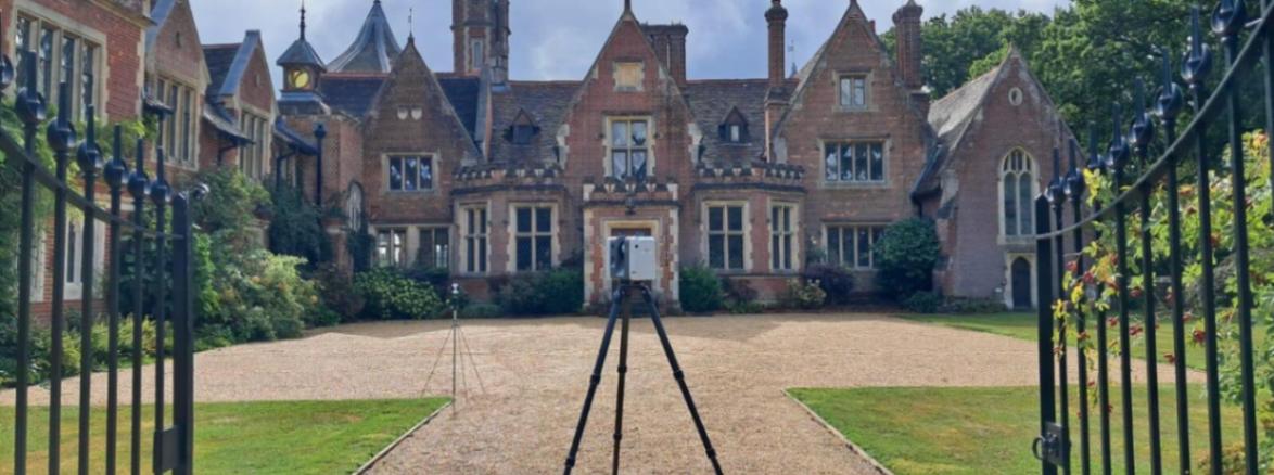
- Measured Building Surveys – Capturing the precise internal and external dimensions of the existing structure using high-speed laser scanning.
- Floor Plan Measurement – Creating accurate internal layouts that document the exact position of structural walls and openings.
- Elevation Recording – Producing vertical drawings of the building facades to assist with aesthetic design and planning submissions.
- Topographical Site Surveys – Mapping ground levels and terrain features to ensure safe drainage design and foundation depth calculations.
- Boundary Identification – Verifying property limits through physical measurements to avoid encroachment disputes with neighbouring owners.
Why Should You Choose Professional Extension Survey Services?
Choosing our professional extension survey ensures your project is built on a foundation of absolute technical integrity and geospatial accuracy. Our experts use regularly calibrated instrumentation and hold specific indemnity coverages that unvetted providers lack, which minimises the risk of building over boundaries or miscalculating earthwork.
This expert oversight maximises your project's efficiency, providing a clear audit trail and protecting your investment from the financial fallout of mapping errors.
When Should You Carry Out an Extension Survey?
You should carry out an extension survey during the early feasibility or pre-design phase, well before any formal architectural concepts or site excavations are finalised. Getting our team on-site early helps you identify potential site constraints like varying ground levels or structural defects that could force a total redesign.
Taking this proactive step ensures your planning applications are factual, which reduces project delays and satisfies the due diligence requirements of your lenders and insurers.
Where Are Extension Surveys Required Across Residential and Commercial Properties?
Specialist work provided by an extension survey is required across a diverse spectrum of assets, from individual residential homes to large-scale commercial retail units. This service is critical for listed building consent and complex urban redevelopments where accurate historical plans are often missing from the archive.
By mapping these properties, the process ensures that all structural modifications stay within the physical limits of the site, protecting the developer from the legal and financial repercussions of non-compliance.
How Much Does an Extension Survey Cost?
The professional fee for an extension survey ranges from £450 to over £2,500, depending on the property size, the complexity of the internal layout, and the level of service required.
Costs are primarily driven by the total floor area our team needs to map and whether you require high-resolution 3D Revit models or simple 2D drawings. Technical factors such as the density of internal rooms, the need for supplementary topographical data, and the travel requirements for our geomatic engineers also impact the final professional fee.
Contact Extension Survey to get customised prices for an extension survey at your property.
Get a Free No Obligation Quotation Today
How Does the Extension Survey Process Work?
The technical workflow for an extension survey involves a sequence of site assessment, precision data capture, and meticulous office-based processing to ensure geospatial integrity. Our surveyors establish geodetic control points that provide a fixed reference for all measurements across the property relative to the national grid.
This process ensures that every scan we take is triangulated with absolute accuracy, resulting in a digital output that provides the indisputable evidence your engineering team needs for safe foundation analysis.
Which Homeowners, Developers, and Architects Require Extension Surveys?
A broad range of professional stakeholders requires an extension survey to manage the technical and legal risks of property construction:
- Architectural Practices – Needing detailed plans to ensure new designs fit perfectly within the existing structural shell.
- Residential Developers – Requiring verified site maps to maximise building footprints while adhering to local planning restrictions.
- Structural Engineers – Using precise layouts and levels to calculate load-bearing requirements and design safe, stable foundations.
- Private Homeowners – Seeking factual data for personal renovation projects and ensuring all building work stays within legal boundaries.
- Building Contractors – Relying on accurate maps for precise material specifications and managing site logistics during the build phase.
What Information and Measurements Are Captured in an Extension Survey?
A comprehensive extension survey provides several critical layers of information to facilitate a successful property development project:
- Floor Plans – Mapping the length and width of every internal space using calibrated laser measurement tools.
- Building Elevations – Recording the vertical dimensions of the facades to support accurate roof and storey design.
- Structural Features – Documenting the location of load-bearing walls and chimney stacks to assist engineering planning.
- Terrain Contours – Mapping the ground levels to identify drainage falls and foundation requirements across the terrain.
- Boundary Position – Identifying the position of existing walls and fences to confirm legal site limits.
What Planning Standards and Regulations Apply to Extension Surveys?
Every inspection conducted for an extension survey follows recognised UK standards, most notably the RICS Professional Statement for land and building measurement. Adhering to these national standards ensures your survey is legally defensible and provides the millimetre precision required for structural engineering.
Adhering to these codes provides the insurance-backed certainty that developers and lenders demand when they are funding or protecting high-value land investments across the country.
How Quickly Can an Extension Survey Be Completed?
Professional field work for an extension survey can typically be completed within one day on-site, with final digital plans delivered within three to five working days. The speed of delivery is influenced by the computational processing phase required to translate raw laser measurements into the final CAD format.
This efficiency ensures your design cycle stays on track, providing your team with the high-resolution plans needed to advance the project without unnecessary administrative delays.
Contact Extension Survey for a consultation to get an extension survey tailored to your organisation’s risks and responsibilities.
Request a free quote
What People are Saying About Us
★★★★★
"The survey provided accurate measurements and detailed plans that helped our extension project progress smoothly."
Owen Marlowe
London
★★★★★
"Excellent service with clear drawings that gave our architect everything required."
Leah Corbett
London
★★★★★
"The survey team were professional, punctual and delivered detailed plans within days."
Grant Appleton
London
★★★★★
"Very impressed with the quality of the survey and the level of detail included."
Mia Eastwood
London
Our Locations
We are proud to work nationally across the UK, allowing us to ensure we can provide services to you.
For a full list of counties we cover in the UK, see below.